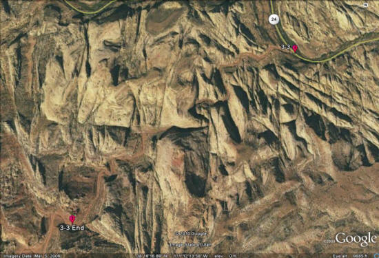
Day 3, Stop 3
Grand Wash Trail
GPS Location:
Start of hike: End of hike:
38o 16.686' N 38o 15.815' N
111o 11.534' W 111o 12.943' W
Ages:
Lower - Middle Jurassic
Rock Units:
Navajo Sandstone
Kayenta Formation
Features Present:
The Grand Wash Trail is an excellent place to see many of the interesting features of the Navajo Sandstone. This hike follows a narrow canyon between Scenic Dr. and Hwy 24, for 2.5 relatively flat miles.
Depositional Environments:
Navajo Sandstone: Eolian
Kayenta Formation: Fluvial
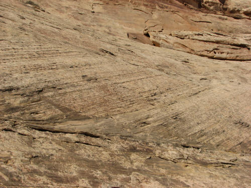
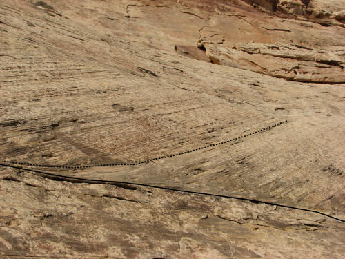
Figures 1-2: Because you can get so close to the preserved dune deposits in Grand Wash, it is an excellent place to see some of the structures of the dunes. In this case it is possible to how deposits on the lee side of the dune decrease in slope as they come down to the toe of the dune, becoming tangential to the underlying flat surface. This flat surface that the dunes toe out into is called a bounding surface, and it separates packages of dune sediments that were deposited at the same time. Bounding surface are classified into one of several orders depending on how extensive they are, the extent of the surface being an indicator of how wide spread the change in deposition was. Because we did not trace this surface out to see how far it extends it is impossible to tell which order it is. A solid black line in the second picture indicates this bounding surface.
There is another type of bounding surface see in this picture. It is called a reactivation surface, and indicates when a previously active dune face became active again following a period of inactivity. The period of inactivity between the two periods when the surface was active shows up due to differential erosion. This surface may only have been inactive for as short as a few months as a result of seasonal variations in wind direction. The dashed black line in the second picture indicates this reactivations surface.
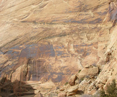
Figure 3: The Navajo Sandstone forms cliffs several hundred feet high for most of the Grand Wash hike. If you look closely at the rock you can see many layers of the stacked trough cross-stratified packages, indicating prolonged deposition in an eolian environment. To get deposits such as these, dunes and interdune flats must have been able to override previous dunes without significantly eroding them. This most likely indicates that there was was enough sand supplied to the region for new dunes to be built without cannibalizing the sand contained in older dunes.
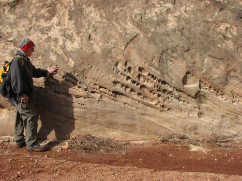
Figure 4: Honeycomb weathering is a common feature in the Navajo Sandstone. While the direct cause of honeycomb weathering is unknown, it is believed to be a result of frost wedging, where water infiltrates the pore spaces between sand grains, freezes and as it expands during freezing slowly fractures parts of the rock off. It is interesting to note that the honeycomb weathering seems to align with the bedding of the cross strata. This may indicate that the cross strata form conduits of high permeability with increased fluid flow parallel to them, allowing more water to fill the pore spaces aligned with the cross strata, and in turn allowing for an increased frost wedging effect.
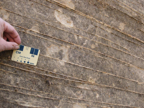
Figure 5: The Grand Wash is one of the best places in the park to see grain flow strata. See the description of the Navajo Sandstone for more information on grain flow strata.
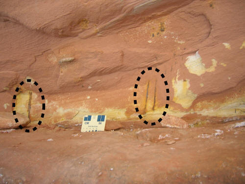
Figure 6: Though there are few if any age diagnostic fossils in the Navajo Sandstone, that does not mean that the Navajo erg was devoid of life. In this picture, inside the dashed ellipses, are examples of rhizoliths in the Navajo Sandstone. Rhizoliths are fossilized plant roots, indicating the presence of plants in the Navajo erg.
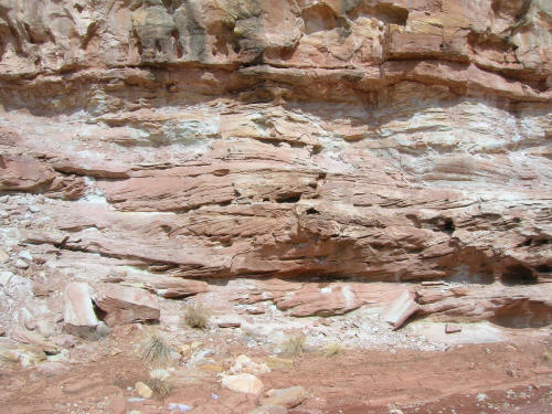
Figure 7: Due to the regional dip of the formations, as you approach the western mouth of the Grand Wash the Kayenta Formation makes up the lower walls of the canyon. By walking towards the west, you slowly move down section and can walk through the entire thickness of the Kayenta formation. By paying close attention to the rock you can see how the formation changed through time. In this example you can see some of the cross bedded fluvial sand common to the top of the Kayenta.
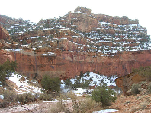
Figure 8: At the very western mouth of the Grand Wash the Wingate Sandstone is exposed as a series of cliffs that slowly climbs higher and higher into the sky due to the regional dip.