Day 2, Stop 9
Chimney Rock and Fault
GPS Location:
38o 18.935' N
111o 18.214' W
Ages:
Triassic - Lower Jurassic
Rock Units:
Wingate Sandstone
Chinle Formation
Moenkopi Formation
Features Present:
Erosion of the rock in the shape of a Chimney
Depositional Environment:
marginal marine to non-marine
The Moenkopi Formation exhibits marginal marine to continental alluvial fans deposits and also includes deltaic, shoreline, mudflat, tidal, estuarine, sabkha (supratidal setting on arid an coastline), fluvial (river), and some minor eolian (carried by wind) deposits. The majority of the Moenkopi at this locality is largely tidal flat and floodplain. The Chinle depositional environments are fluvial and some lacustrine (lake). The Shinarump Member here is a tabular, planar-stratified, fluvial sandstone. The Shinarump has an irregular distribution and may be thick in some areas where it filled in paleovalleys, although elsewhere it can be much thinner to non-existent.
Interpretation:
During the Late Triassic, the supercontinent Pangaea was symmetrically straddling the equator and Utah was located around a paleolatitude of 10° north and was continuing to shift northward entering a more subtropical zone (Dubiel et al. 1991, Dubiel 1994). The Chinle Formation as a whole is a series of fluvial-lacustrine system with a tropical monsoonal climate. This region would receive a good amount of precipitation but would be interrupted by seasonally dry periods. (Dubiel et al., 1991.) Tectonically, the Chinle was deposited in a continental back-arc basin on the west coast of Pangea.
Depositional Environment:
Chinle Formation - Fluvial and floodplains
Moenkopi Formation - Tidal
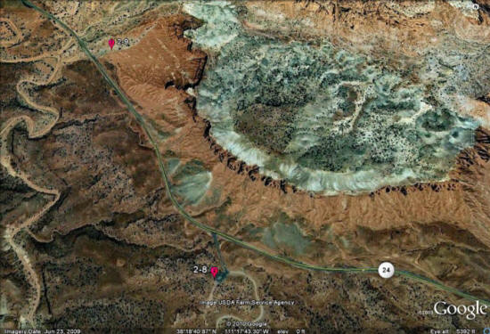
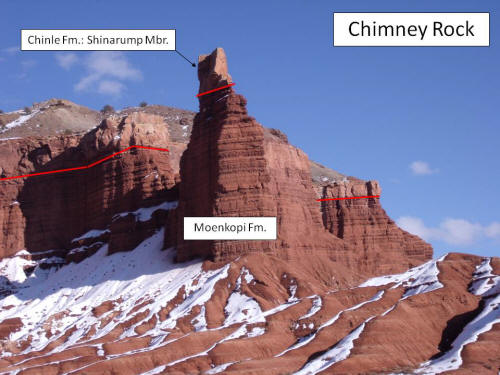
Figure 1: Chimney Rock.
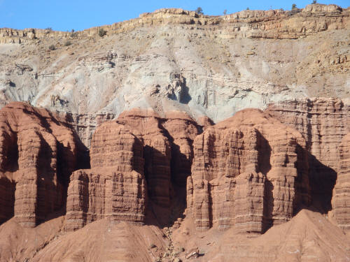
Figure 2: Fault view to the left of Chimney Rock. The Shinarump Member on the left side of the photograph is downdropped compared to the right side. The blue dotted line indicates the inferred location of a normal fault. The footwall is the Moenkopi Formation overlain by the Shinarump (right of photo) and the hanging wall is the Shinarump overlain by the Wingate (left of photo).