Day 2, Stop 7
Petroglyphs
GPS Location:
38o 17.903' N
111o 16.338' W
Ages:
Triassic - Lower Jurassic
Rock Units:
Wingate Sandstone
Chinle Formation
Moenkopi Formation
Features Present:
The view of the Castle from the Capitol Reef National Park Visitor Center is very popular, but the view of The Castle from the west along Hwy 24 is still spectacular. From here, one can see the dark red Moenkopi Formation and the variegated Chinle Formation, capped by the tall cliffs of the Wingate Sandstone that have weathered into the Castle.
On the south side of the road is a good outcrop of the Moenkopi Formation in an acessible stream bed. Here there are many sedimentary structures exposed along bedding planes, such as different varieties and sizes of ripple marks (Figures 3 and 4) and trace fossils (fossils left by animal activity) including reptile "scrapes" in the mud (Figures 5 and 6).
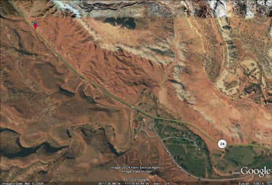

Figure 1: View from the side of Hwy 24 showing the backside of The Castle. Lines show the contacts between the prominent formations.
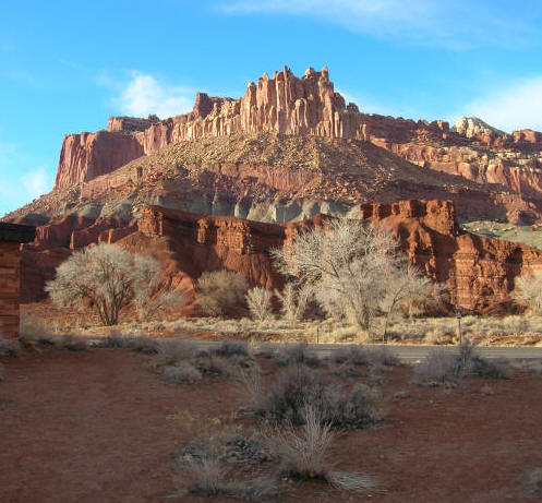
Figure 2: View of The Castle from the Capitol Reef National Park Visitor Center.
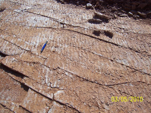
Figure 3: Wave ripples along a bedding plane surface of the Moenkopi Formation.
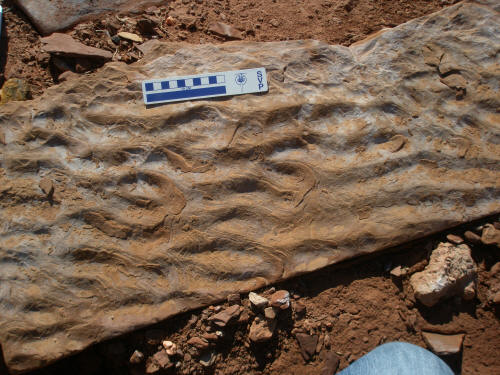
Figure 4: Complex ripples seen on one of the shale beds in the Moenkopi Formation.
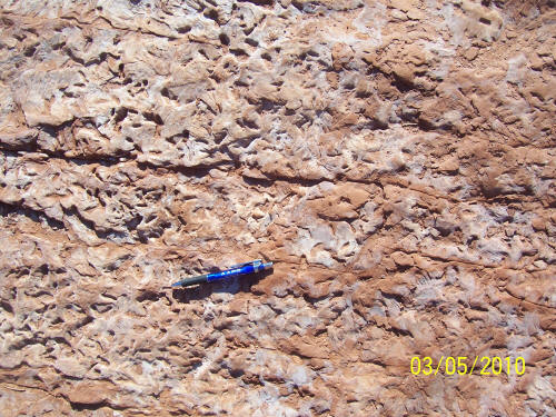
Figure 5: Bioturbation structures where worms burrowed through the mud leaving U-shaped burrows (paired holes).
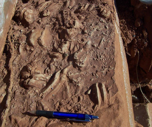
Figure 6: Vertebrate "smears". This is where a small reptile swimming through the body of water scraped its claws through the mud on the bottom. The scrapes were then cast and filled with overlying sand.