Day 2, Stop 3
Navajo Waterfall
GPS Location:
38o 17.296' N
111o 09.774' W
Ages:
Early - Middle Jurassic
Rock Units:
Page Sandstone
Navajo Sandstone
Features Present:
The waterfall overlook is a good place to view the contact between the Navajo Sandstone and the overlying Page Sandstone. Because they are of very similar lithology, the Page Sandstone and Navajo Sandstone were not originally differentiated as separate formations. It was not until the recognition that the J-2 unconformity, subtly indicated by a lag deposit, was a disconformable surface separating the two formations that stratigraphers identified them as two separate formations. The Page Sandstone is separated into three members, which are identified below (Mathis 2000).
Across Hwy 24 from the waterfall overlook is the abandoned former channel of the Fremont River. In 1962 the Fremont River was rerouted as part of construction of Hwy 24. Exposed in the east wall of this former channel are soft sediment deformation structures in the uppermost Navajo Sandstone. In general, the upper third of the Navajo Sandstone formation contains more soft sediment deformation than lower portions. This may indicate that it was deposited in a wetter environment, or perhaps that watertable flucuations were an important factor in soft sediment deformation.
Depositional Environment:
Eolian
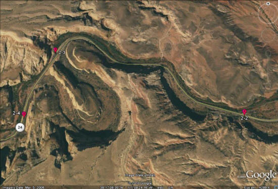
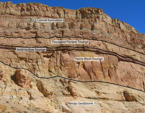
Figure 1:The Page Sandstone is subdivided into three members. The lowermost member, the Harris Wash Tongue, is the thickest and is composed of trough cross-bedded sands grading up into planar-bedded sands. This indicates a transition from a dune field to a sand sheet environment, which could indicate that the environment was becoming wetter through time. The next member is the recessive, shaley Judd Hollow Tongue, which records a wet, muddy flood plain environment. This would have been the wettest period during the deposition of the Page Sandstone and would have been marked by the presence of lakes, fluvial channels and an absence of sand dunes. The top member is the Thousand Pockets Tongue, composed primarily of trough cross strata that are smaller in size than the lower Harris Wash Tongue. This indicates a return to a drier environment with sand dunes, after the wet Judd Hollow interval.
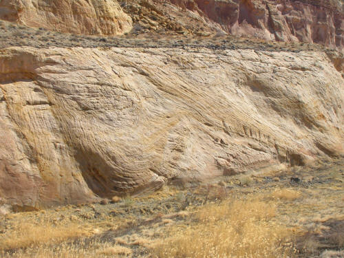
Figure 2: This picture shows some soft sediment deformation in the east side of the former Fremont River channel. In the right side of the picture the bedding is trough cross stratification, fairly typical to the Navajo Sandstone. To the left side of the picture the strata are vertical, and in between the strata curve from vertical to pointing to the upper right. The origin of this soft sediment deformation is unknown, though it has been speculated that it is a fluid escape structure. Fluid escape structures do not usually leave behind vertically bedded strata, so the ultimate cause of the soft sediment is still a mystery.