Day 1, Stop 3
Summerville Formation
Location:
Immediately west of Hanksville. Summerville Formation outcrop on the north side of Highway 24.
GPS Location:
38o 22.263' N
110o 45.064' W
Ages:
Late Jurassic, deposited during early to late Oxfordian time (161 - 155 Ma) (Wilcox, 2007)
Rock Units:
Summerville Formation
Features Present:
The Summerville Formation consists of two generalized lithofacies including a silty mudstone/sandstone and an upper facies of more gypsiferous mudstone and sandstone (Wilcox, 2007). Intercalated chocolate red mudstones, very fine- to fine-grained sandstones, and gypsum are typical of Summerville Formation in outcrop (Figure 1). Bedding is dominantly tabular. Sedimentary structures include ripple cross lamination (Figure 2) and polygonal mudcracks filled with light-colored sand (Figure 3).
Depositional Environment:
Tidal. The Summerville Formation is mud-dominated intertidal to supratidal deposits of the Jurassic epicontinental sea. The lower boundary of Summerville is gradational with upper facies of the marine Curtis Formation and indicates a gradual shallowing of sea through time. Caputo and Pryor (1991) describe the deposition of Summerville as mud rich, restricted, evaporative, hypersaline conditions. Upper Summerville, with its desiccation mud cracks and ever present evaporite stringers, represents the supratidal stage of the upward shallowing cycle in the last vestiges of the receding Jurassic seaway.
Interpretation:
The reddish brown silty facies and gypsiferous facies in the Summerville Formation were deposited in the supratidal stage of the upward shallowing cycle in the Curtis-Summerville regression (Caputo and Pryor, 1991). The Summerville Formation tabular sand bodies and mudstones are interpreted to represent a tidal flat environment. The presence of polygonal sand filled shrinkage cracks (Figure 3) suggests periodic subaerial exposure. Numerous thin evaporite layers formed from hypersaline waters that periodically dried up. The lack of trace fossils indicates a paucity of life possibly due to an ecologically stressed paleoenvironment. Upper Summerville in some areas is interpreted to represent a sabkha environment (Wilcox, 2007).
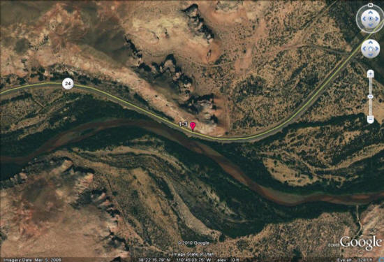
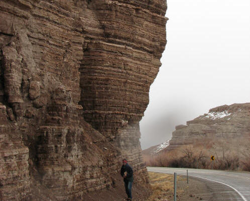
Figure 1: Summerville Formation outcrop on Highway 24, grain size and bed thickness tend to increase up section.
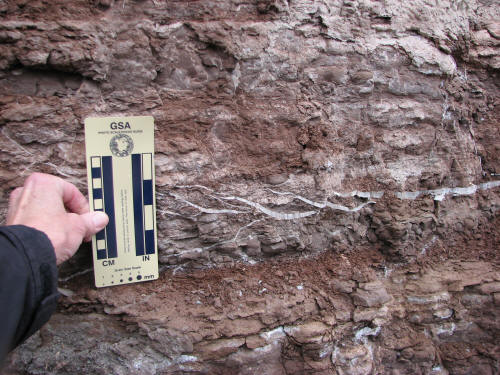
Figure 2: Gypsum stringers cut across ripple forms.
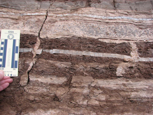
Figure 3: Vertical mudcracks filled with sand, representing polygonal desiccation cracks in the clay bed.