MOrrison Formation
(Tidewell Member, Salt Wash Member, Brushy Basin Member)
Age: Late Jurassic (Kimmeridgian) 155-148 Ma
Depositional Environment: Alluvial plain, fluvial channels and floodplains with paleosols
Tectonics:
Subduction to the west created a back arc rift basin (between Morrison basin and paleo Pacific Ocean).
Mountain ranges (rift shoulder) to the west were source for clastic sediment
Calderas in rift basin provided abundant ash fall during Brushy Basin deposition
Climate:
Located ~32° N (modern southern AZ)
Prevailing easterly winds (present day NE due to
rotation of plate)
Warm, dry climate with high evaporation
Features:
Morrison Formation - 180-200 m thick
Tidwell Member (oldest)
Alluvial plain – streams, overbank deposits, paleosols;
locally (in Capitol Reef area)
gypsiferous, hyper-saline lagoons
Varicolored mudstone with interbedded sandstone,
limestone, gypsum
Salt Wash Member (middle)
Fluvial channel deposits, floodplain deposits, crevasse
splays
Predominately fine/medium sand - coarse sand/ pebble
conglomerates; trough stratification,
fining upward
Brushy Basin Member (youngest)
Lacustrine/ wetlands; local fluvial channels
Varicolored mudstone
Mostly ground and surface water flowing to the east
(present day NE)
Losing streams with associated riparian environments
prograding to the east
Floodplains with paleosols; grassy savannahs
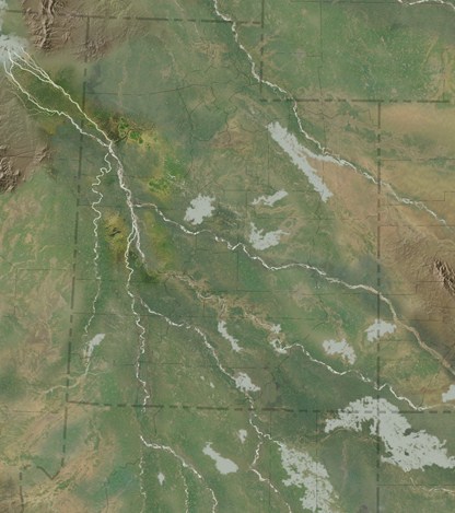
Figure 1: Paleogeographic map of the Middle Jurassic, Page Sandstone, Carmel Formation, Entrada Sandstone, Curtis Formation, and Summerville Formation. (Blakey, 2008)
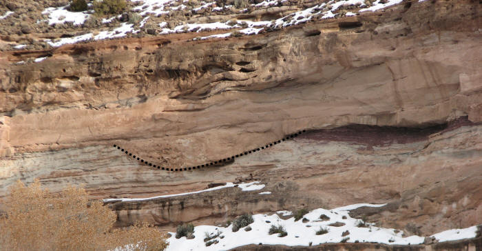
Figure 2: Channel in Salt Wash Member (outlined with dotted line).